“Manoyo guato taegüe y espiritumo? pat manoyo jufalagüe taegüe yo gui menamo?”
“Ya estaba güije un disipulo guiya Damasco, na y naanña si Ananias;
sa güiya sinangane ni y Señot gui vision, ilegña:
Ananias;
ya güiya ilegña: Estagüiyajayo Señot.
Ya y Señot ilegña nu güiya:
Cajulo ya janao falag y caye ni y mafanaan tunas, ya unaligao y guima Judas,
uno na y naanña Saulo, taotao Tarso, sa estagüe na mananaetae,
Ya guinin jalie gui vision un taotao na y naanña si Ananias,
na mato ya japolo y canaeña guiya güiya para uninafanlie.
Ya si Ananias, manope ilegña: Señot, megae jujungog ni este na taotao,
na megae na taelaye finatinasña gui mañantosmo guiya Jerusalem.
Ya güine na gaeninasiña guinin y magas mamale, para ugode todo
ayo sija y umaagang y naanmo. Lao y Señot ilegña nu güiya:
Janao unjanao; sa güiya y inayeg na nayan guiya guajo,
para uchule y naanjo gui menan y Gentiles, yan y ray sija, yan y famaguon
Israel: Sa guajo fumanue güe cuanto mandangculon
güinaja, na janesesita umasapet pot y naanjo.
Ya si Ananias jumanao, ya jumalom gui guima; ya japolo y canaeña guiya
güiya, ilegña: Chelujo Saulo, y Señot as Jesus ni y mato guiya
jago gui chalan anae mamamaela jao, jatagoyo para usiña unlie,
yan unbula ni y Espiritu Santo. Ya enseguidas manbasnag guinin y
mataña taegüije y guenaf sija: ya manlie, ya cajulo ya matagpange.”
“Si Jeova japlanta y tronuña gui langet sija; yan y raenoña y naregla y jilo todoja.” Salmo 139:7;
Y Checho Sija 9:10-18; Salmo 103:19 (Josephine Chargualaf Varley, Narrator, Salmo 103).
Photo Credits:
1. Top Left (Full size Original or Processed): Agrihan, Commonwealth of the Northern Mariana Islands (USA). Earth Sciences and Image Analysis, NASA-Johnson Space Center. 8 December 2003. "Astronaut Photography of Earth - Quick View." <http://eol.jsc.nasa.gov/scripts/sseop/QuickView.pl?directory=ESC&ID=ISS007-E-9881>; National Aeronautics and Space Administration (NASA, http://www.nasa.gov), Government of the United States of America (USA).
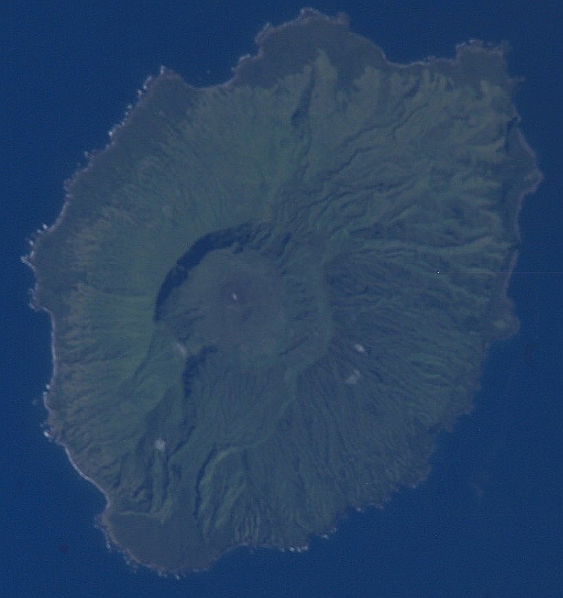
2. Top Middle (Full size Original or Processed): Pagan, Commonwealth of the Northern Mariana Islands (USA). Earth Sciences and Image Analysis, NASA-Johnson Space Center. 8 December 2003. "Astronaut Photography of Earth - Quick View." <http://eol.jsc.nasa.gov/scripts/sseop/QuickView.pl?directory=ESC&ID=ISS006-E-42417>; National Aeronautics and Space Administration (NASA, http://www.nasa.gov), Government of the United States of America (USA).
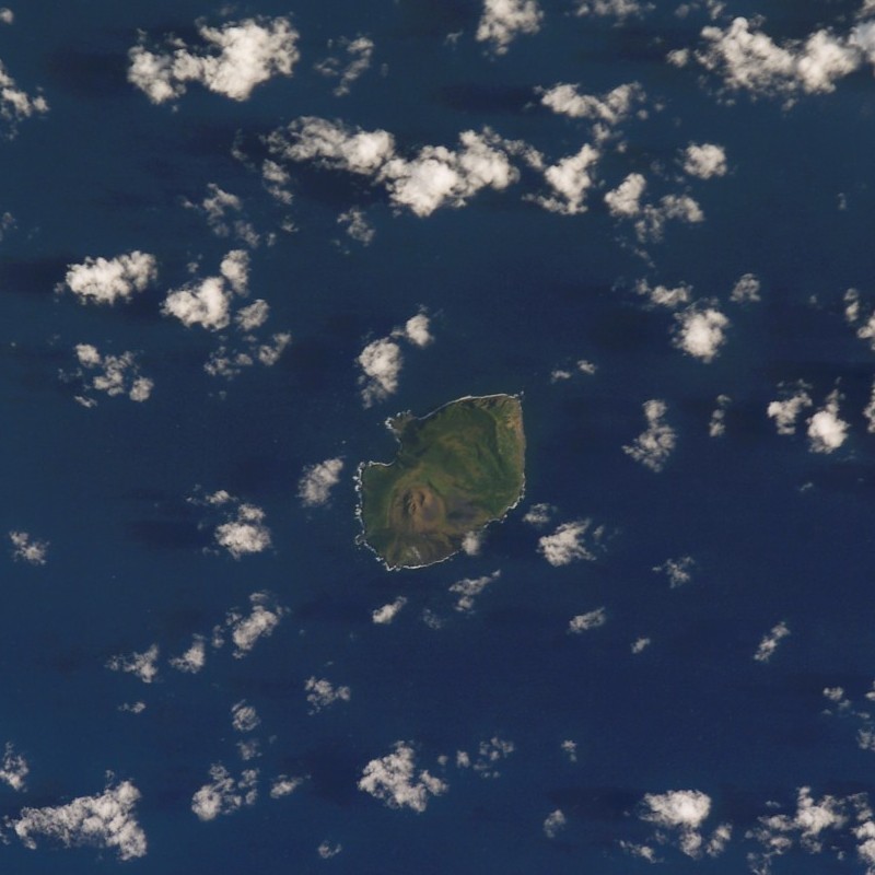
3. Top Right (Full size Original or Processed): Guguan, Commonwealth of the Northern Mariana Islands (USA). Earth Sciences and Image Analysis, NASA-Johnson Space Center. 8 December 2003. "Astronaut Photography of Earth - Quick View." <http://eol.jsc.nasa.gov/scripts/sseop/QuickView.pl?directory=ESC&ID=STS107-E-5467>; National Aeronautics and Space Administration (NASA, http://www.nasa.gov), Government of the United States of America (USA).
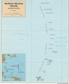
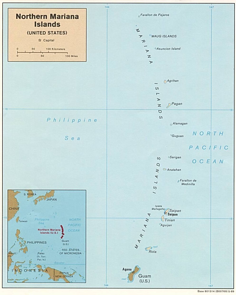
4. Second Row, Left (Full size): Map of the Commonwealth of the Northern Mariana Islands (Political), 1989. The World Factbook (http://cia.gov/cia/publications/factbook) or CIA Maps and Publications Released to the Public (http://www.cia.gov/cia/publications/mapspub), Central Intelligence Agency (CIA, http://www.cia.gov), Government of the United States of America (USA); and the Perry-Castañeda Map Collection (http://www.lib.utexas.edu/maps), Perry-Castañeda Library, The General Libraries, University of Texas at Austin, Austin, Texas, USA.
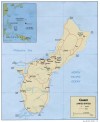
5. Second Row, Right (Full size): Map of Guam (Political), 1991. The World Factbook (http://cia.gov/cia/publications/factbook) or CIA Maps and Publications Released to the Public (http://www.cia.gov/cia/publications/mapspub), Central Intelligence Agency (CIA, http://www.cia.gov), Government of the United States of America (USA); and the Perry-Castañeda Map Collection (http://www.lib.utexas.edu/maps), Perry-Castañeda Library, The General Libraries, University of Texas at Austin, Austin, Texas, USA.
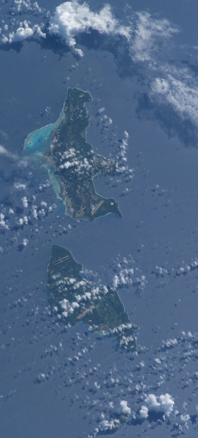
6. Third Row, Left (Full size Original or Processed): Saipan, Commonwealth of the Northern Mariana Islands (USA), and Tinian, Commonwealth of the Northern Mariana Islands (USA). Earth Sciences and Image Analysis, NASA-Johnson Space Center. 8 December 2003. "Astronaut Photography of Earth - Quick View." <http://eol.jsc.nasa.gov/scripts/sseop/QuickView.pl?directory=ESC&ID=ISS007-E-5424>; National Aeronautics and Space Administration (NASA, http://www.nasa.gov), Government of the United States of America (USA).
7. Third Row, Middle (Full size Original or Processed): Luta (Rota), Commonwealth of the Northern Mariana Islands (USA). Earth Sciences and Image Analysis, NASA-Johnson Space Center. 8 December 2003. "Astronaut Photography of Earth - Quick View." <http://eol.jsc.nasa.gov/scripts/sseop/QuickView.pl?directory=ESC&ID=STS112-E-5360>; National Aeronautics and Space Administration (NASA, http://www.nasa.gov), Government of the United States of America (USA).
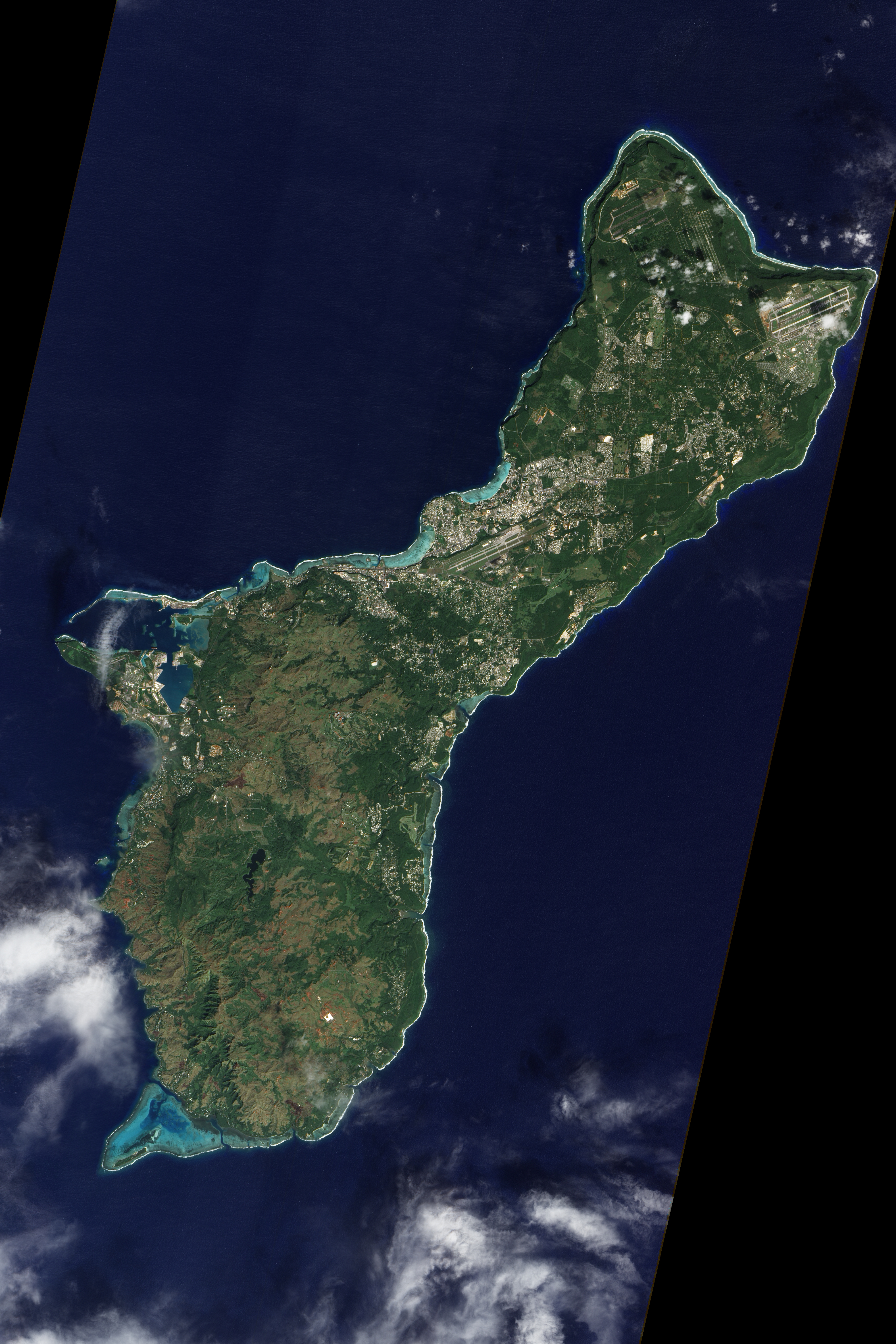
8. Third Row, Right (Full size Original or Processed): Guåhan (United States Territory of Guam). Earth Sciences and Image Analysis, NASA-Johnson Space Center. 8 December 2003. "Astronaut Photography of Earth - Quick View." <http://eol.jsc.nasa.gov/scripts/sseop/QuickView.pl?directory=ESC&ID=ISS007-E-5427>; National Aeronautics and Space Administration (NASA, http://www.nasa.gov), Government of the United States of America (USA).
9. Fourth Row, Left (Full size): Guahan (United States Territory of Guam) . Earth Sciences and Image Analysis, NASA-Johnson Space Center. 8 December 2003. "Astronaut Photography of Earth - Quick View." <http://eol.jsc.nasa.gov/scripts/sseop/QuickView.pl?directory=ESC&ID=STS068-258-55>; National Aeronautics and Space Administration (NASA, http://www.nasa.gov), Government of the United States of America (USA).
10. Fourth Row, Right (Full size Huge, Very Large, Large, Medium, or Other): National Aeronautics and Space Administration (NASA, http://www.nasa.gov), Government of the United States of America.
The Manguaguan na Palabran Si Yuus Archive
The Great Earthquake and Catastrophic Tsunami of 2004
The Spectacular Clouds of the Transonic Flight Regime
The Chamorro Bible In Print


