“Y langet sija iyomo, yan yo tano locue iyomo: y tano yan y binilan sinajguanña ni y plinantamo sija.
Yanguin ñalangyo, ti jusanganejao; sa iyoco y tano, yan y sinajguanña.
Y tano iyon Jeova yan y binilaña: y tano yan y manasaga gui sanjalomña. Sa güiya fumatinas gui jilo y tase:
ya gui jilo y janom nae japolo fitme.” Salmo 89:11; Salmo 50:12; Salmo 24:1-2.

Large Medium
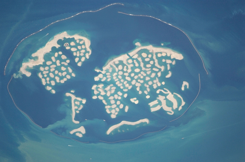
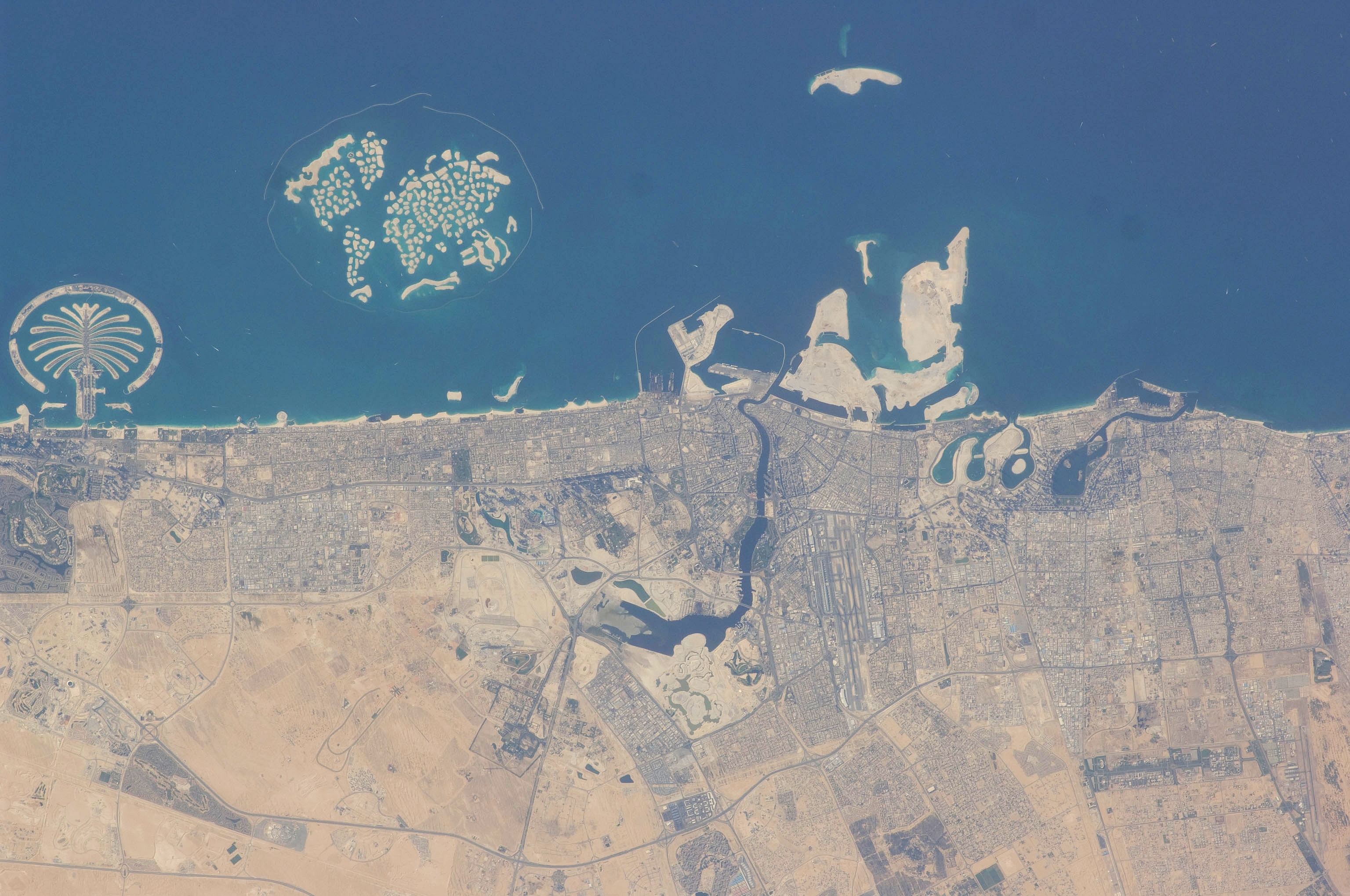
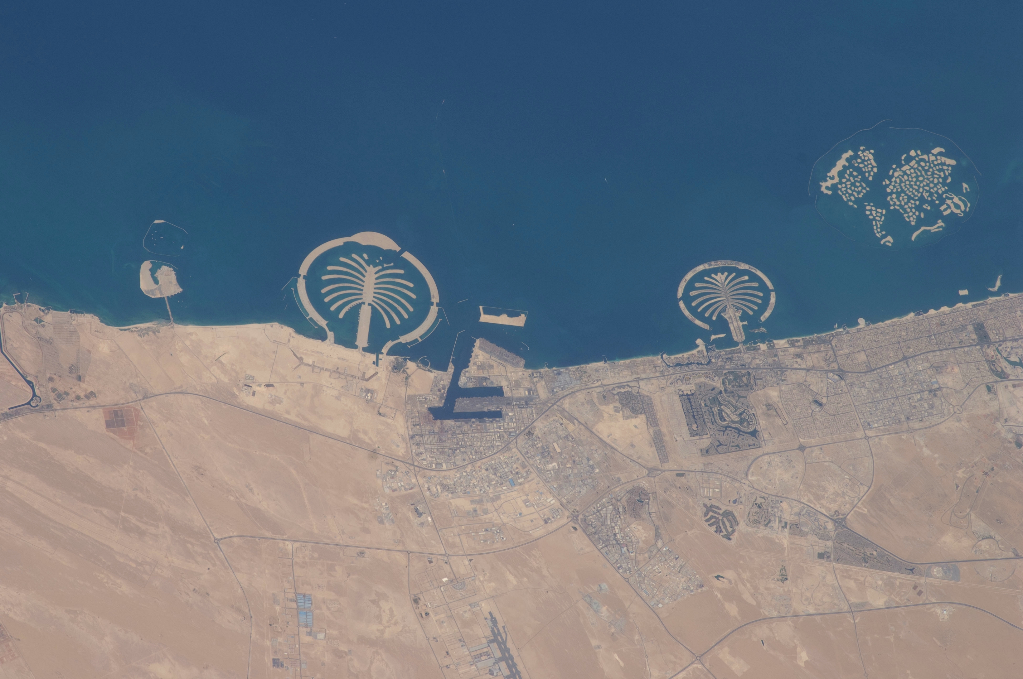
1. Palm Jebel Ali, Palm Jumeirah, and The World, Dubai, Al Imarat al Arabiyah al Muttahidah – United Arab Emirates
February 1, 2009 at 07:58:12 GMT
As Seen From the International Space Station (Expedition 18)
Latitude (LAT): 27.3 · Longitude (LON): 55.3 · Altitude (ALT): 189 Nautical Miles · Sun Azimuth (AZI): 168° · Sun Elevation Angle (ELEV): 45° |
| |
Large Medium
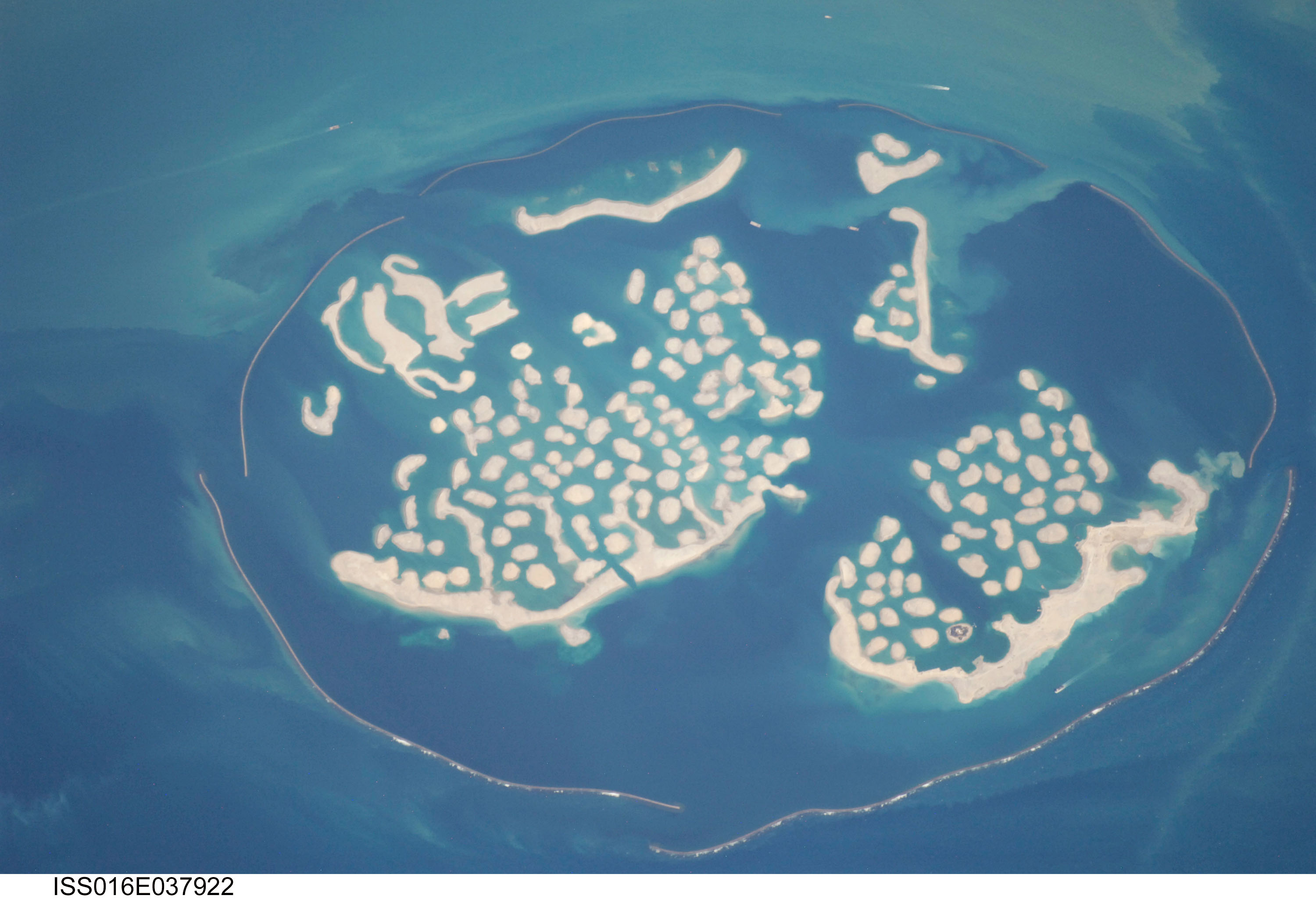
2. The World, Dubai, Al Imarat al Arabiyah al Muttahidah – United Arab Emirates
April 3, 2008 at 11:53:21.240 GMT
As Seen From the International Space Station (Expedition 16)
Latitude (LAT): 26.3 · Longitude (LON): 53.8 · Altitude (ALT): 181 Nautical Miles · Sun Azimuth (AZI): 256° · Sun Elevation Angle (ELEV): 37° |
| |

Large Medium
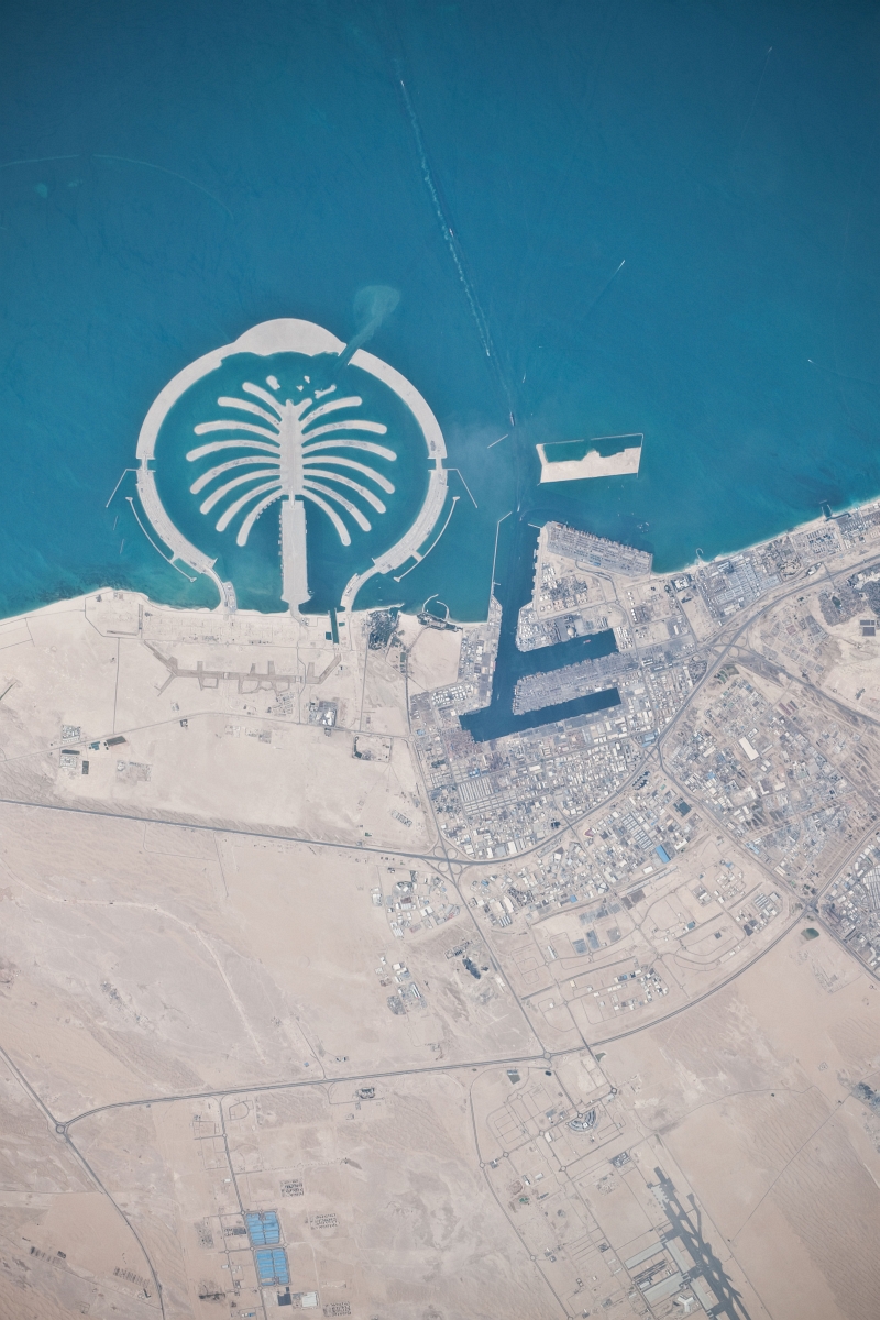
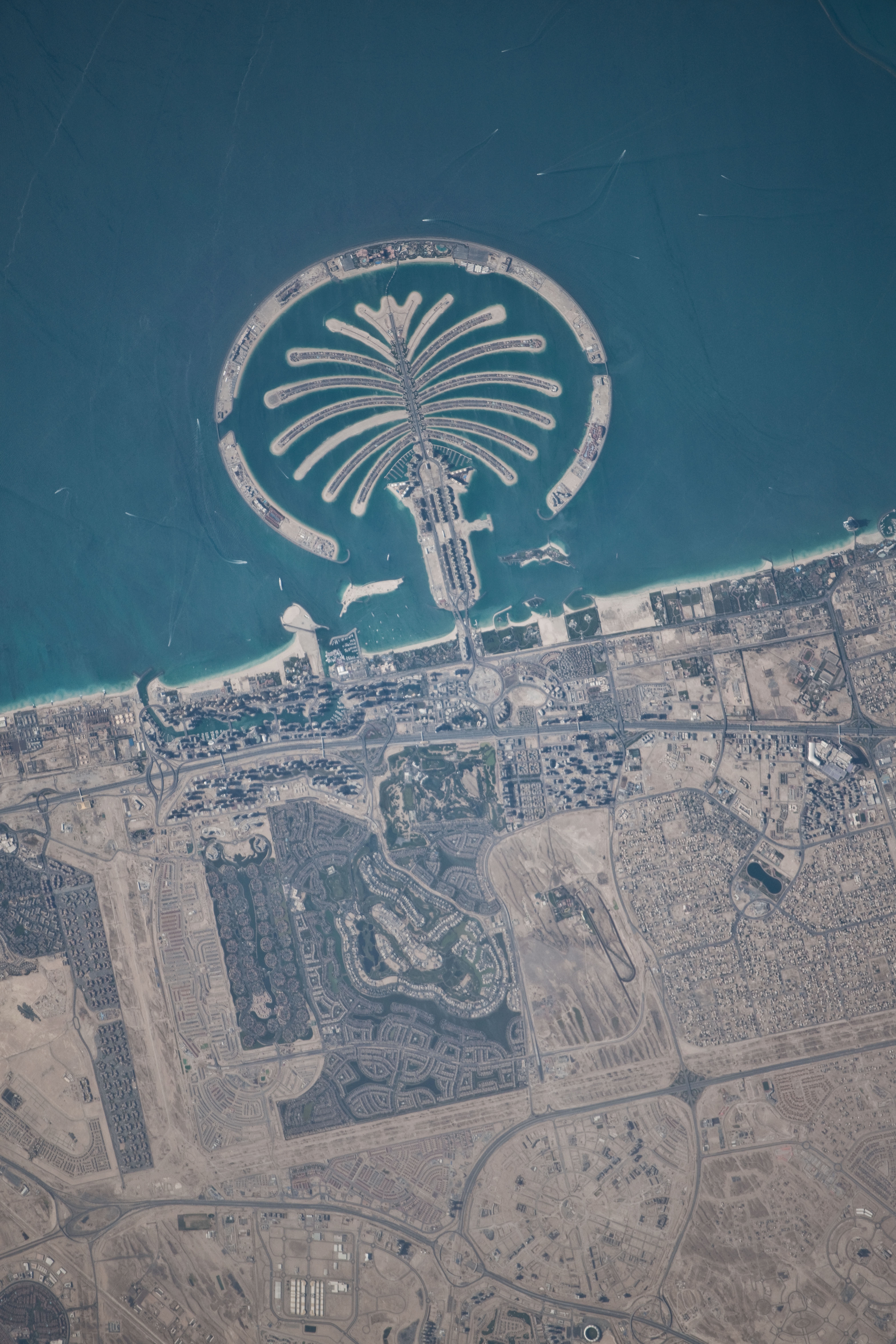
3. Palm Jumeirah, Dubai, Al Imarat al Arabiyah al Muttahidah – United Arab Emirates
February 1, 2009 at 07:57:26 GMT
As Seen From the International Space Station (Expedition 18)
Latitude (LAT): 25.1 · Longitude (LON): 53.1 · Altitude (ALT): 189 Nautical Miles · Sun Azimuth (AZI): 165° · Sun Elevation Angle (ELEV): 47° |
| |

Large Medium
4. Palm Jebel Ali, Dubai, Al Imarat al Arabiyah al Muttahidah – United Arab Emirates
February 1, 2009 at 07:57:21 GMT
As Seen From the International Space Station (Expedition 18)
Latitude (LAT): 24.9 · Longitude (LON): 52.9 · Altitude (ALT): 189 Nautical Miles · Sun Azimuth (AZI): 164° · Sun Elevation Angle (ELEV): 47° |
| |

Large Medium
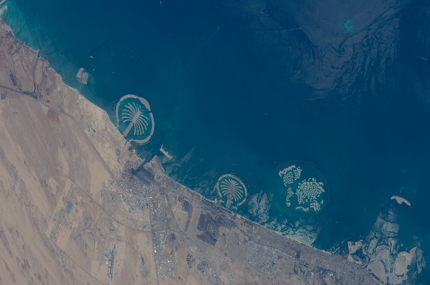
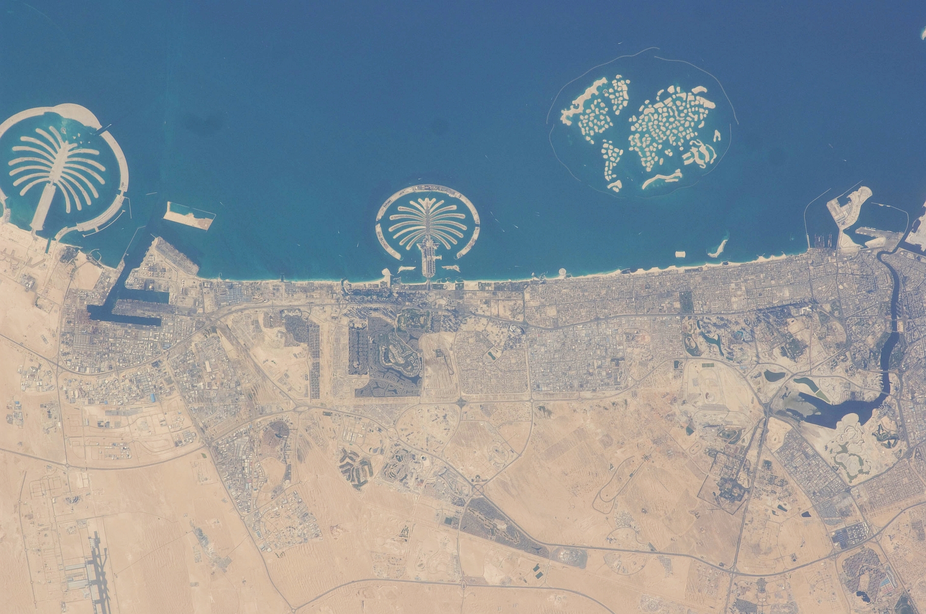
5. Palm Jebel Ali and Palm Jumeirah, Dubai, Al Imarat al Arabiyah al Muttahidah – United Arab Emirates
March 20, 2009 at 12:39:57 GMT
As Seen From the International Space Station (Expedition 18)
Latitude (LAT): 25.5 · Longitude (LON): 55.1 · Altitude (ALT): 191 Nautical Miles · Sun Azimuth (AZI): 258° · Sun Elevation Angle (ELEV): 24° |
| |

Large Medium
6. Palm Jumeirah, Dubai, Al Imarat al Arabiyah al Muttahidah – United Arab Emirates
February 1, 2009 at 07:57:48 GMT
As Seen From the International Space Station (Expedition 18)
Latitude (LAT): 26.2 · Longitude (LON): 54.1 · Altitude (ALT): 189 Nautical Miles · Sun Azimuth (AZI): 166° · Sun Elevation Angle (ELEV): 46° |
| |

Large Medium
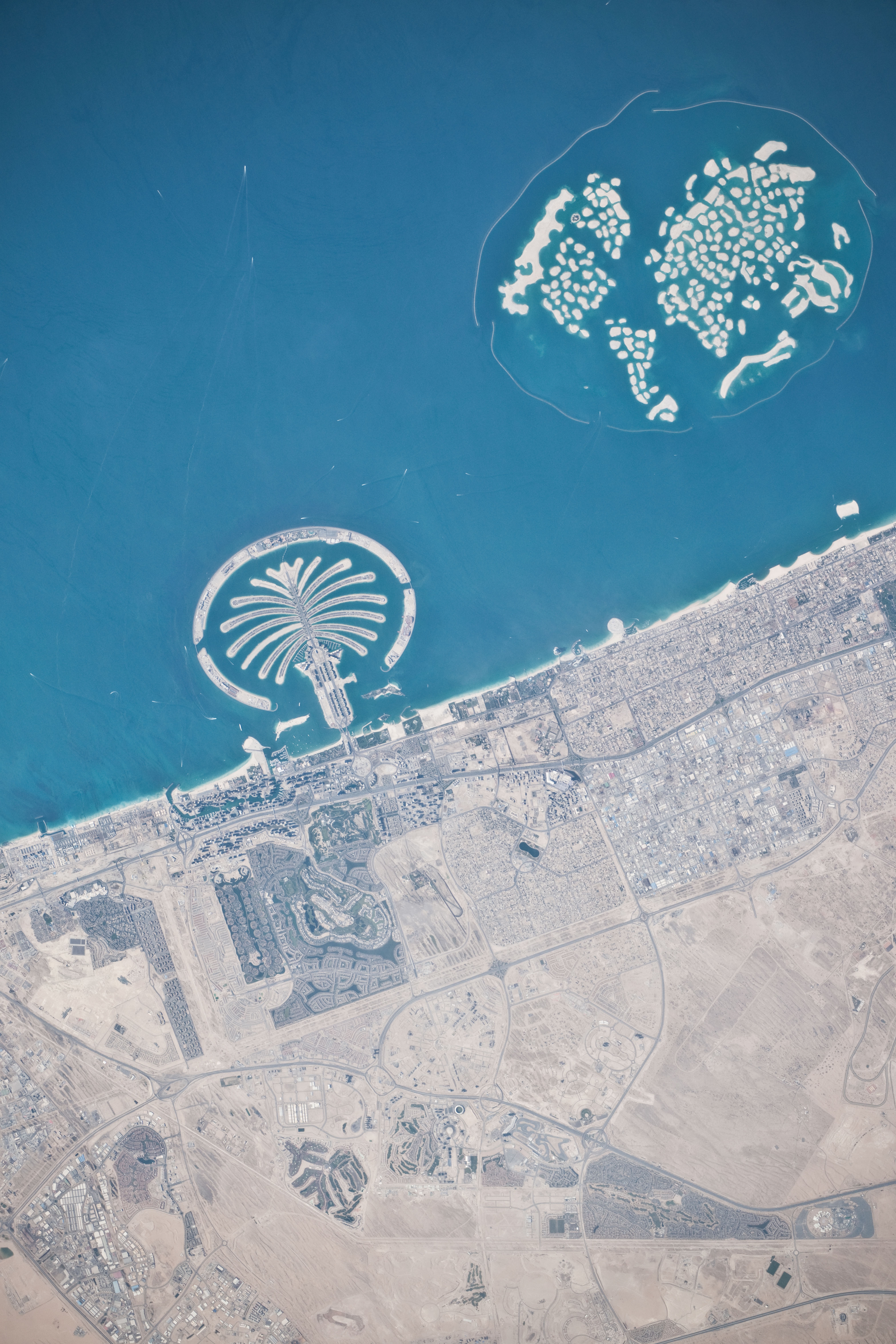
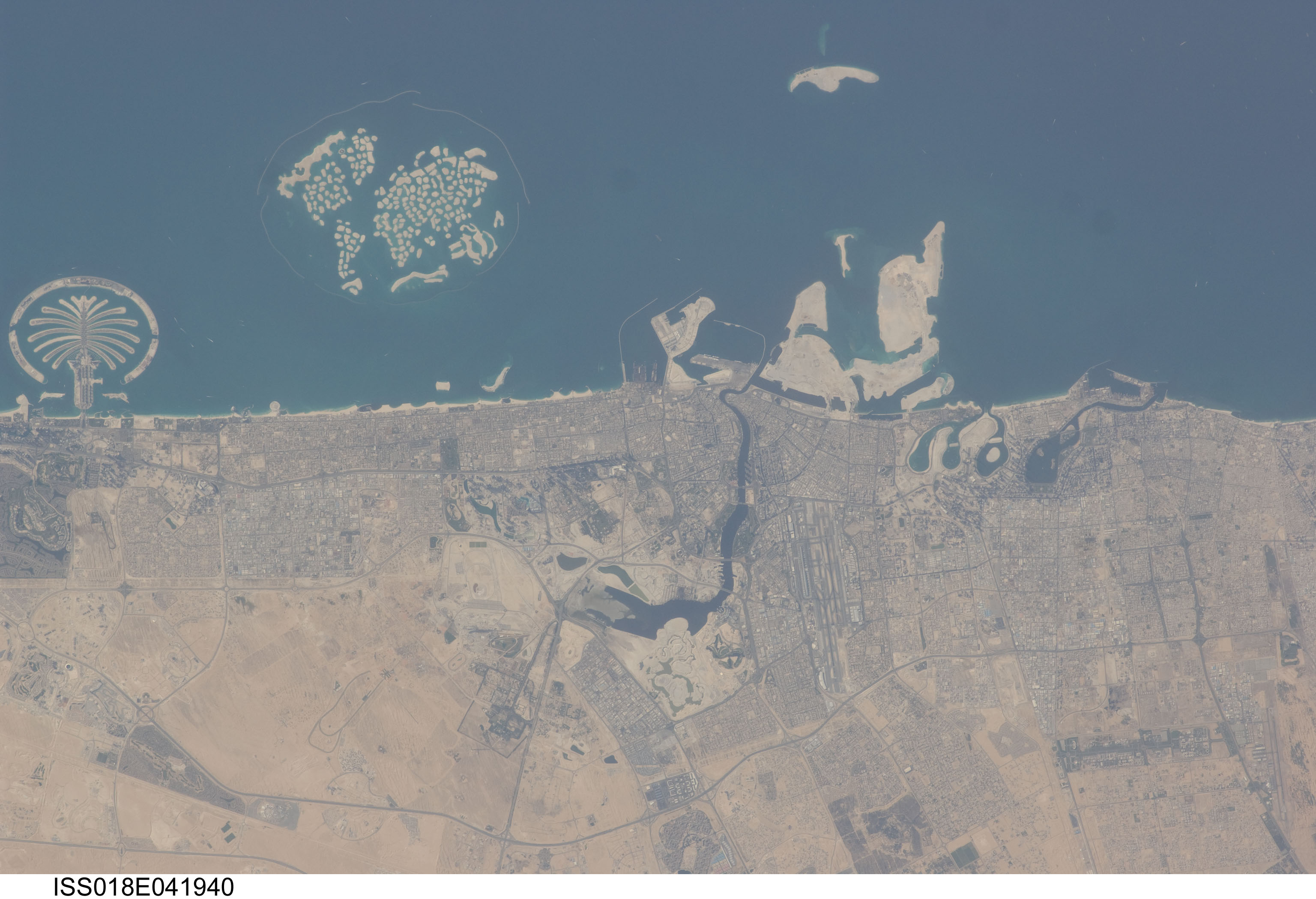
7. Palm Jumeirah, and The World, Dubai, Al Imarat al Arabiyah al Muttahidah – United Arab Emirates
March 20, 2009 at 12:39:59 GMT
As Seen From the International Space Station (Expedition 18)
Latitude (LAT): 25.6 · Longitude (LON): 55.2 · Altitude (ALT): 191 Nautical Miles · Sun Azimuth (AZI): 258° · Sun Elevation Angle (ELEV): 24° |
| |

Large Medium
8. Palm Jebel Ali, Palm Jumeirah, and The World, Dubai, Al Imarat al Arabiyah al Muttahidah – United Arab Emirates
March 20, 2009 at 12:39:58 GMT
As Seen From the International Space Station (Expedition 18)
Latitude (LAT): 25.5 · Longitude (LON): 55.1 · Altitude (ALT): 191 Nautical Miles · Sun Azimuth (AZI): 258° · Sun Elevation Angle (ELEV): 24° |
| |
Huge Large Medium Other
9. Palm Jebel Ali, Dubai, Al Imarat al Arabiyah al Muttahidah – United Arab Emirates
March 13, 2010 at 10:32:46 GMT
As Seen From the International Space Station (Expedition 22)
Latitude (LAT): 26.1 · Longitude (LON): 55.7 · Altitude (ALT): 183 Nautical Miles · Sun Azimuth (AZI): 231° · Sun Elevation Angle (ELEV): 48° |
| |

Huge Large Medium Other
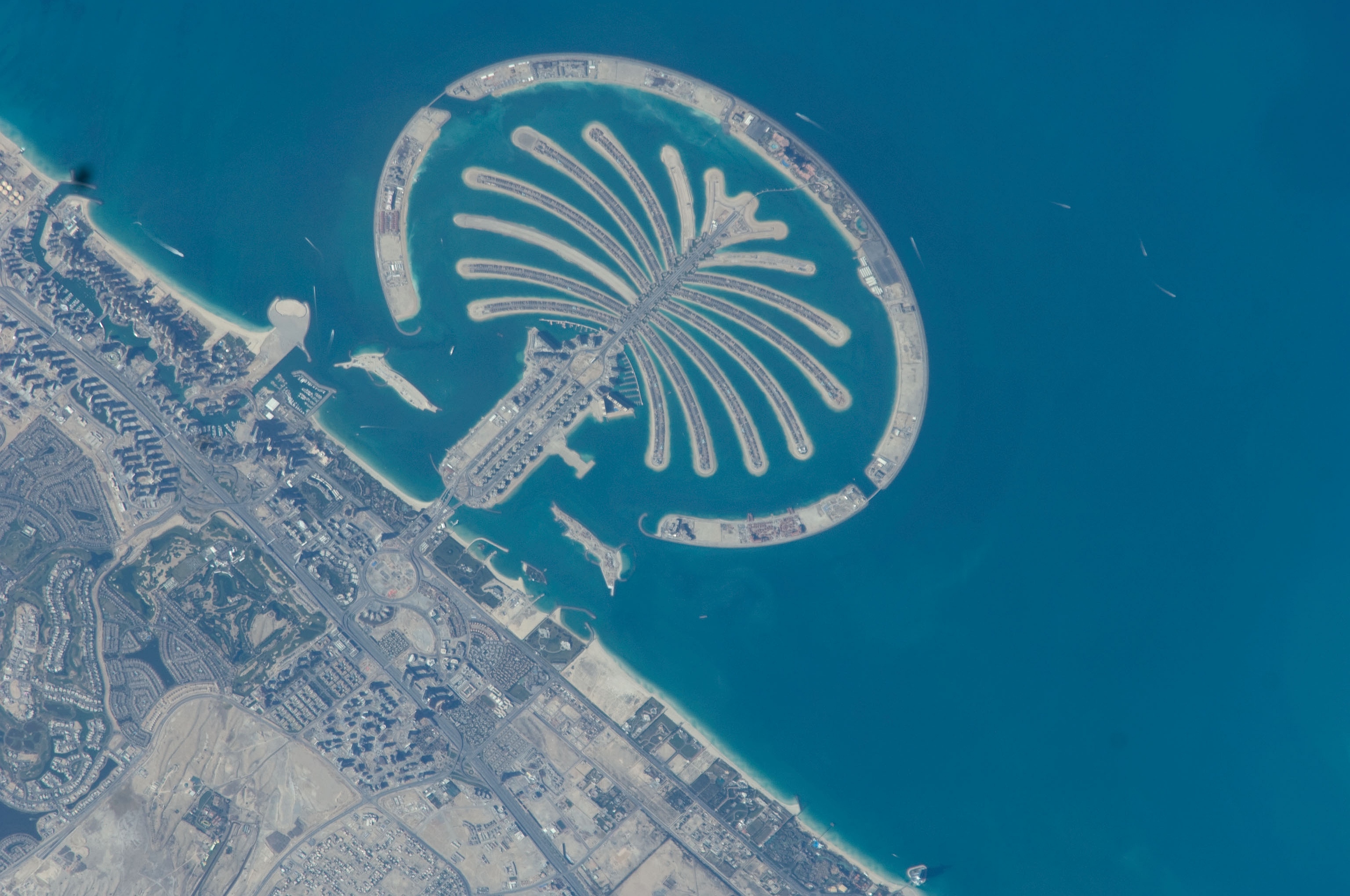
10. Palm Jumeirah, Dubai, Al Imarat al Arabiyah al Muttahidah – United Arab Emirates
March 13, 2010 at 10:32:55 GMT
As Seen From the International Space Station (Expedition 22)
Latitude (LAT): 26.6 · Longitude (LON): 56.1 · Altitude (ALT): 183 Nautical Miles · Sun Azimuth (AZI): 231° · Sun Elevation Angle (ELEV): 47° |
| |

Huge Large Medium Other
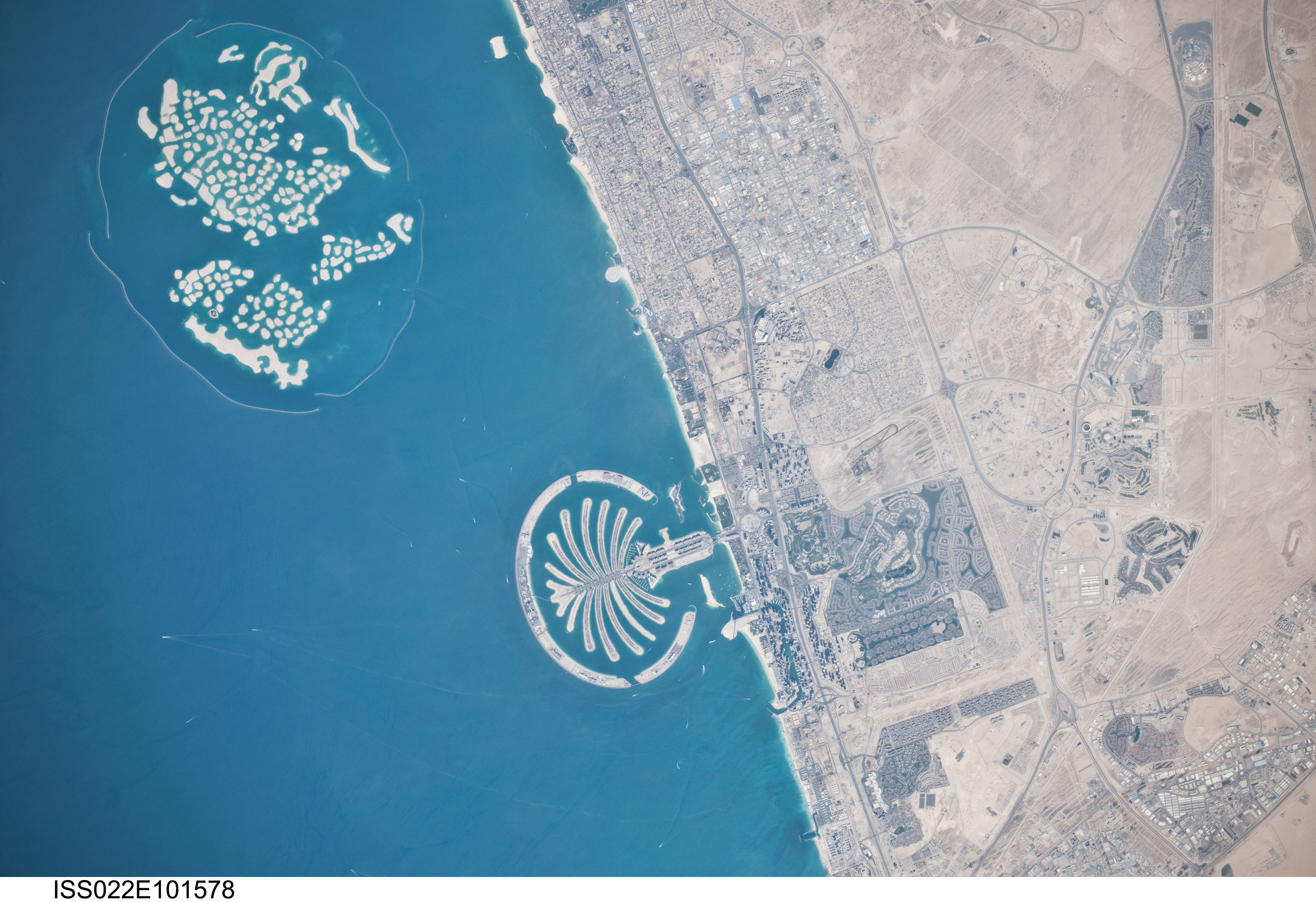
11. Palm Jumeirah and The World, Dubai, Al Imarat al Arabiyah al Muttahidah – United Arab Emirates
March 13, 2010 at 10:32:48 GMT
As Seen From the International Space Station (Expedition 22)
Latitude (LAT): 26.2 · Longitude (LON): 55.8 · Altitude (ALT): 183 Nautical Miles · Sun Azimuth (AZI): 231° · Sun Elevation Angle (ELEV): 48° |
| |

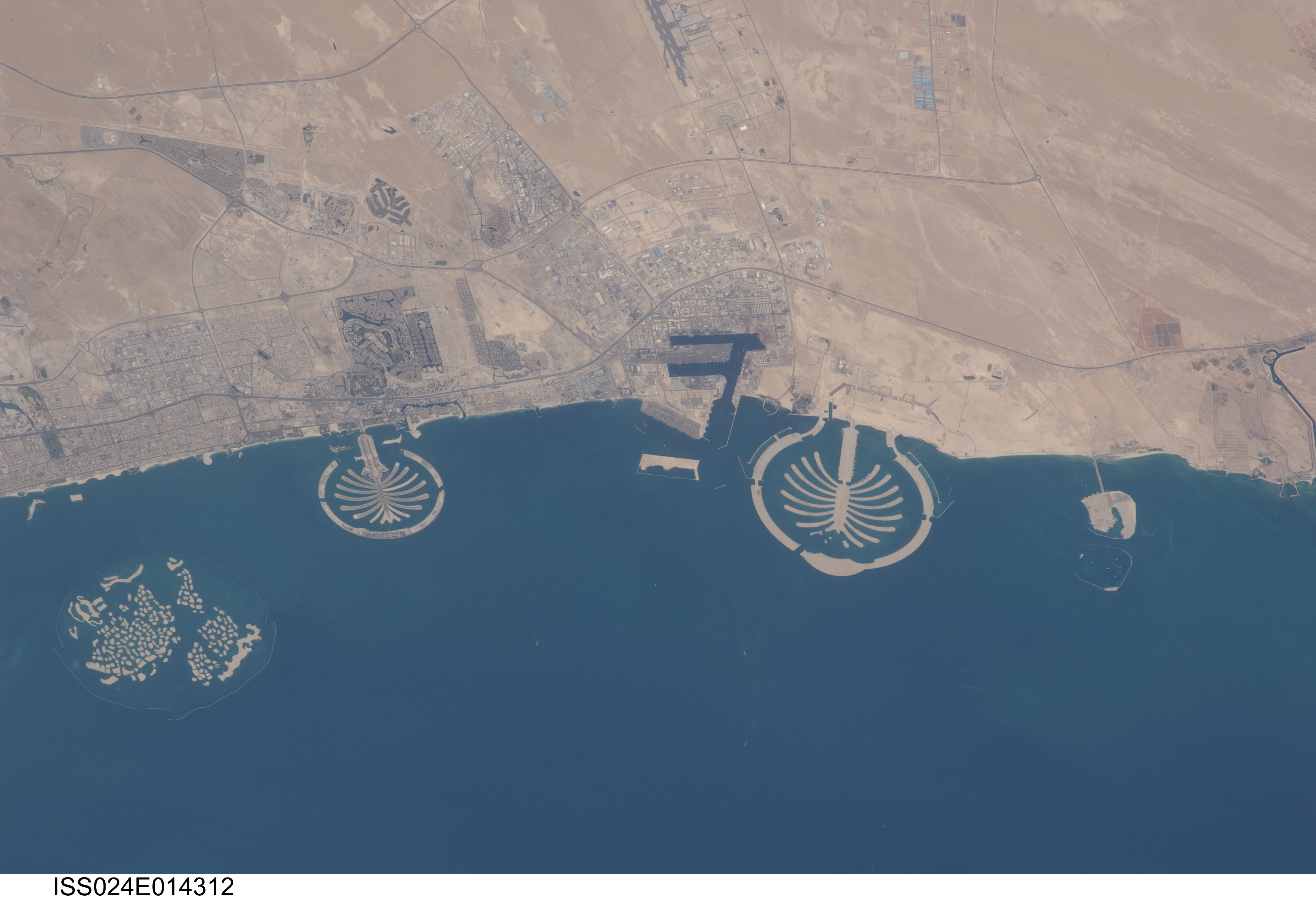
Huge Large Medium Other
12. Palm Jebel Ali, Palm Jumeirah, and The World, Dubai, Al Imarat al Arabiyah al Muttahidah – United Arab Emirates
September 13, 2010 at 07:27:42 GMT
As Seen From the International Space Station (Expedition 24)
Latitude (LAT): 23.0 · Longitude (LON): 55.1 · Altitude (ALT): 187 Nautical Miles · Sun Azimuth (AZI): 147° · Sun Elevation Angle (ELEV): 68° |
Photo Credits:
1. First Row (Full size Original–Local copy, Large, or Medium): NASA, International Space Station (Expedition 18); ISS018-E-25364, Palm Jebel Ali and Palm Jumeirah (The Palm Islands), The World (World Islands), Dubai, United Arab Emirates; Image Science and Analysis Laboratory, NASA-Johnson Space Center. "Astronaut Photography of Earth - Display Record." <http://eol.jsc.nasa.gov/scripts/sseop/photo.pl?mission=ISS018&roll=E&frame=25364>; National Aeronautics and Space Administration (NASA, http://www.nasa.gov), Government of the United States of America (USA).
2. Second Row (Full size Original–Local copy, Large, or Medium): NASA, International Space Station (Expedition 16); ISS016-E-37922, The World (World Islands), Dubai, United Arab Emirates; Image Science and Analysis Laboratory, NASA-Johnson Space Center. "Astronaut Photography of Earth - Display Record." <http://eol.jsc.nasa.gov/scripts/sseop/photo.pl?mission=ISS016&roll=E&frame=37922>; National Aeronautics and Space Administration (NASA, http://www.nasa.gov), Government of the United States of America (USA).
3. Third Row (Full size Original–Local copy, Large, or Medium): NASA, International Space Station (Expedition 18); ISS018-E-26061, Palm Jumeirah (The Palm Islands), Dubai, United Arab Emirates; Image Science and Analysis Laboratory, NASA-Johnson Space Center. "Astronaut Photography of Earth - Display Record." <http://eol.jsc.nasa.gov/scripts/sseop/photo.pl?mission=ISS018&roll=E&frame=26061>; National Aeronautics and Space Administration (NASA, http://www.nasa.gov), Government of the United States of America (USA).
4. Fourth Row (Full size Original–Local copy, Large, or Medium): NASA, International Space Station (Expedition 18); ISS018-E-26059, Palm Jebel Ali (The Palm Islands), Dubai, United Arab Emirates; Image Science and Analysis Laboratory, NASA-Johnson Space Center. "Astronaut Photography of Earth - Display Record." <http://eol.jsc.nasa.gov/scripts/sseop/photo.pl?mission=ISS018&roll=E&frame=26059>; National Aeronautics and Space Administration (NASA, http://www.nasa.gov), Government of the United States of America (USA).
5. Fifth Row (Full size Original–Local copy, Large, or Medium): NASA, International Space Station (Expedition 18); ISS018-E-41938, Palm Jebel Ali and Palm Jumeirah (The Palm Islands), Dubai, United Arab Emirates; Image Science and Analysis Laboratory, NASA-Johnson Space Center. "Astronaut Photography of Earth - Display Record." <http://eol.jsc.nasa.gov/scripts/sseop/photo.pl?mission=ISS018&roll=E&frame=41938>; National Aeronautics and Space Administration (NASA, http://www.nasa.gov), Government of the United States of America (USA).
6. Sixth Row (Full size Original–Local copy, Large, or Medium): NASA, International Space Station (Expedition 18); ISS018-E-26072, Palm Jumeirah (The Palm Islands), Dubai, United Arab Emirates; Image Science and Analysis Laboratory, NASA-Johnson Space Center. "Astronaut Photography of Earth - Display Record." <http://eol.jsc.nasa.gov/scripts/sseop/photo.pl?mission=ISS018&roll=E&frame=26072>; National Aeronautics and Space Administration (NASA, http://www.nasa.gov), Government of the United States of America (USA).
7. Seventh Row (Full size Original–Local copy, Large, or Medium): NASA, International Space Station (Expedition 18); ISS018-E-41940, Palm Jumeirah (The Palm Islands), The World (World Islands); Image Science and Analysis Laboratory, NASA-Johnson Space Center. "Astronaut Photography of Earth - Display Record." <http://eol.jsc.nasa.gov/scripts/sseop/photo.pl?mission=ISS018&roll=E&frame=41940>; National Aeronautics and Space Administration (NASA, http://www.nasa.gov), Government of the United States of America (USA).
8. Eighth Row (Full size Original–Local copy, Large, or Medium): NASA, International Space Station (Expedition 18); ISS018-E-41939, Palm Jebel Ali and Palm Jumeirah (The Palm Islands), The World (World Islands), Dubai, United Arab Emirates; Image Science and Analysis Laboratory, NASA-Johnson Space Center. "Astronaut Photography of Earth - Display Record." <http://eol.jsc.nasa.gov/scripts/sseop/photo.pl?mission=ISS018&roll=E&frame=41939>; National Aeronautics and Space Administration (NASA, http://www.nasa.gov), Government of the United States of America (USA).
9. Ninth Row (Full size Original–Local copy, Huge, Large, Medium, or Other): NASA, International Space Station (Expedition 22), ISS022-E-101577; Image Science and Analysis Laboratory, NASA-Johnson Space Center. "Astronaut Photography of Earth - Display Record." <http://eol.jsc.nasa.gov/scripts/sseop/photo.pl?mission=ISS022&roll=E&frame=101577>; National Aeronautics and Space Administration (NASA, http://www.nasa.gov), Government of the United States of America (USA).
10. Tenth Row (Full size Original–Local copy, Huge, Large, Medium, or Other): NASA, International Space Station (Expedition 22), ISS022-E-101580; Image Science and Analysis Laboratory, NASA-Johnson Space Center. "Astronaut Photography of Earth - Display Record." <http://eol.jsc.nasa.gov/scripts/sseop/photo.pl?mission=ISS022&roll=E&frame=101580>; National Aeronautics and Space Administration (NASA, http://www.nasa.gov), Government of the United States of America (USA).
11. Eleventh Row (Full size Original–Local copy, Huge, Large, Medium, or Other): NASA, International Space Station (Expedition 22), ISS022-E-101578; Image Science and Analysis Laboratory, NASA-Johnson Space Center. "Astronaut Photography of Earth - Display Record." <http://eol.jsc.nasa.gov/scripts/sseop/photo.pl?mission=ISS022&roll=E&frame=101578>; National Aeronautics and Space Administration (NASA, http://www.nasa.gov), Government of the United States of America (USA).
12. Twelfth Row (Full size Original–Local copy, Huge, Large, Medium, or Other): NASA, International Space Station (Expedition 24), ISS024-E-14312; Image Science and Analysis Laboratory, NASA-Johnson Space Center. "Astronaut Photography of Earth - Display Record." <http://eol.jsc.nasa.gov/scripts/sseop/photo.pl?mission=ISS024&roll=E&frame=14312>; National Aeronautics and Space Administration (NASA, http://www.nasa.gov), Government of the United States of America (USA).
The Manguaguan na Palabran Si Yuus Archive
The Great Earthquake and Catastrophic Tsunami of 2004
The Spectacular Clouds of the Transonic Flight Regime
The Chamorro Bible In Print


